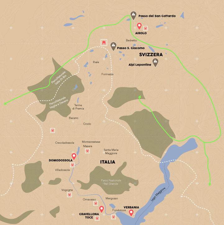
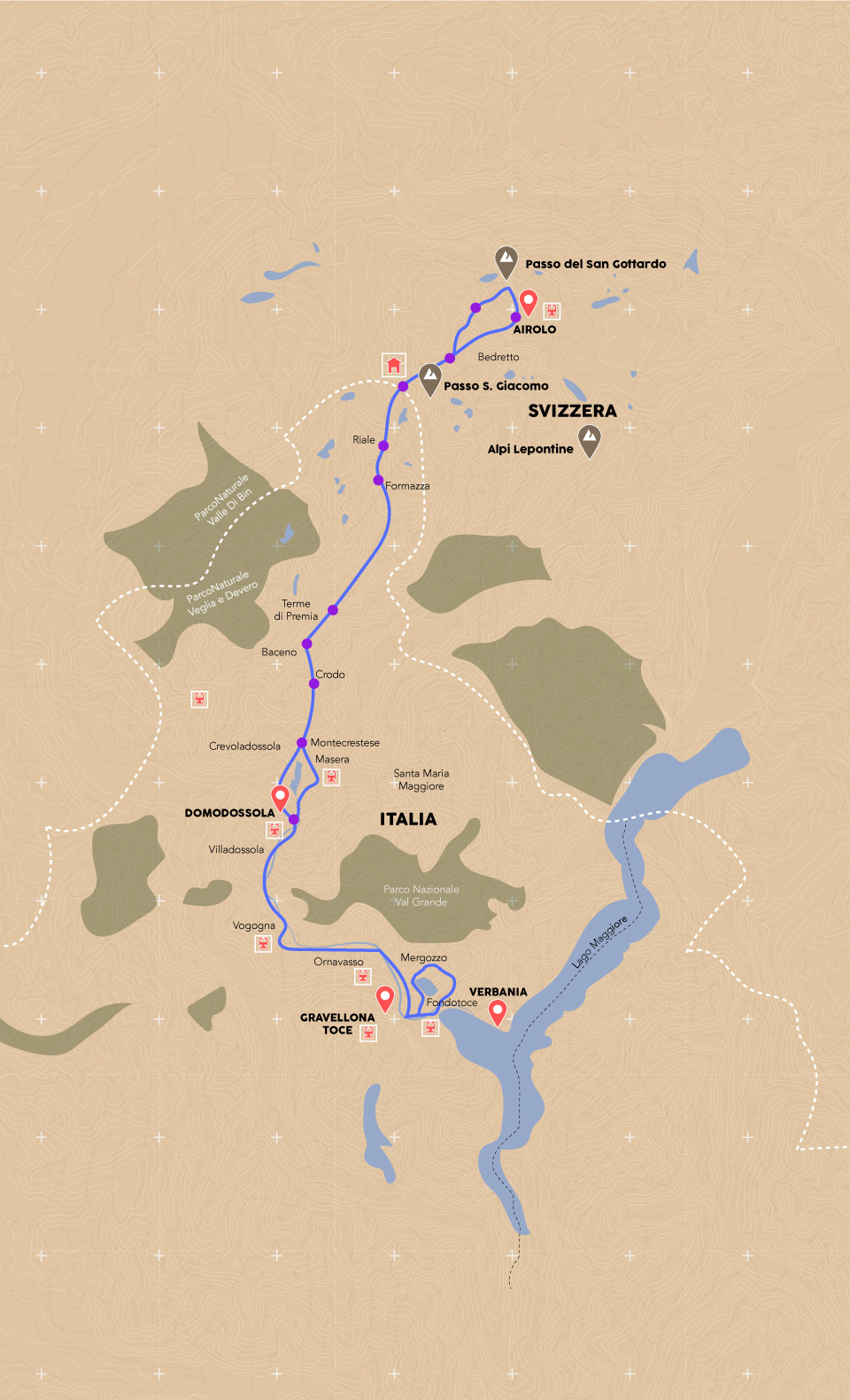
The routes
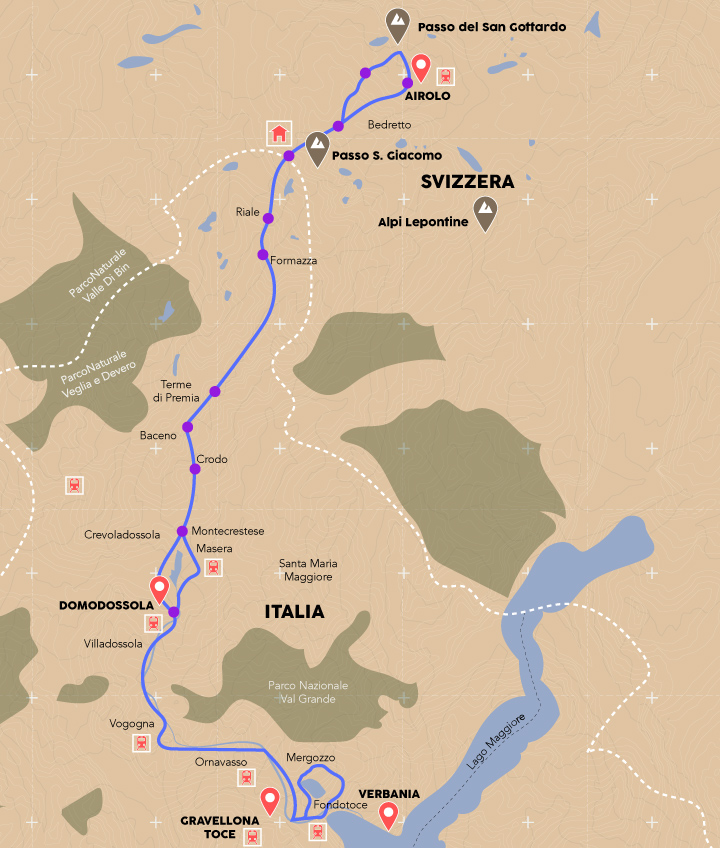
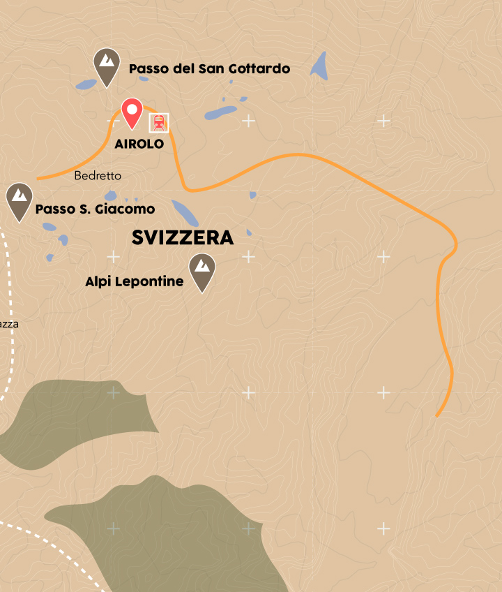
Taking as a starting point, the highest point, there are many ways to go to the 2,300 meters of the San Giacomo pass:
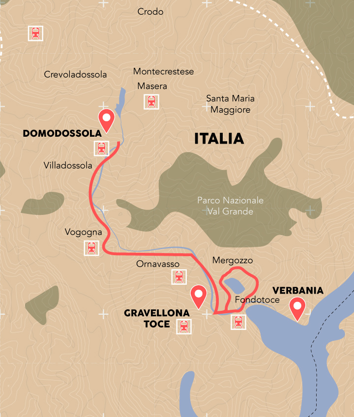
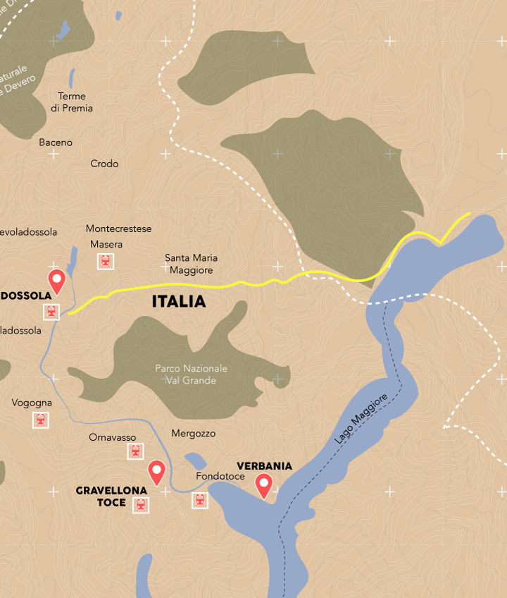
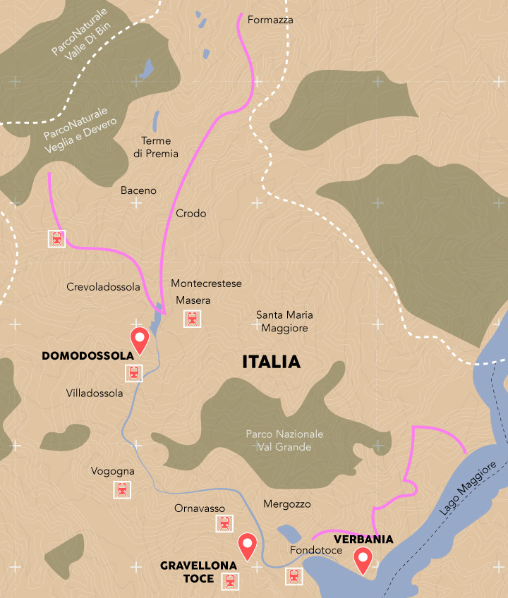
Toward the north you will find the Swiss Val Bedretto which, with the descent of the Valle Leventina, will take you to Bellinzona, the Piano di Magadino, Locarno and Verbano. To the south, here is the Formazza, the Antigorio, the Ossola, the lake of Mergozzo, the cane thicket of Fondotoce and the noble view of the Borromeo Gulf. If, on the other hand, you are in Verbania, on the shores of the lake, the cycle path, which has just been completed, crosses the special nature reserve of Fondotoce.
Here, among the thousand possibilities, you can find yourself in the middle of one of the largest reed beds in Verbano. A naturalistic paradise which, in every season, frames the view of the Borromean Gulf and the mountains of Val Grande National Park. If you then turn your gaze to the background, you can see the perennial snows of the Pennines that reach 4,000 metres.
From the cane thicket, take the road that goes up, in Antigorio Valley, where the spectacle of the ravines of Uriezzo will leave you amazed. They are canyons that project the visitor into a primordial environment: smooth rocks in tortuous paths, pools of clear water, alternating with rapids and waterfalls. A unique emotion, reachable from Verampli di Crodo, Baceno or Premia.
Another adventurous route is towards Toce waterfalls. In Val Formazza, its 143-meters drop caused the amazement of writers, artists and nobles between the 19th and 20th centuries, earning it the nickname of “the most beautiful and powerful waterfall in the Alps”. In the summer months, when the inflow of water is at its maximum, its 60-meters front creates a wall of water. Reaching its 1,675 meters of altitude, looking out from the overhanging observation point, in a cloud of steam amidst the roar and swirl of the waters, is one of the things to do at least once in a lifetime in the Lake District.
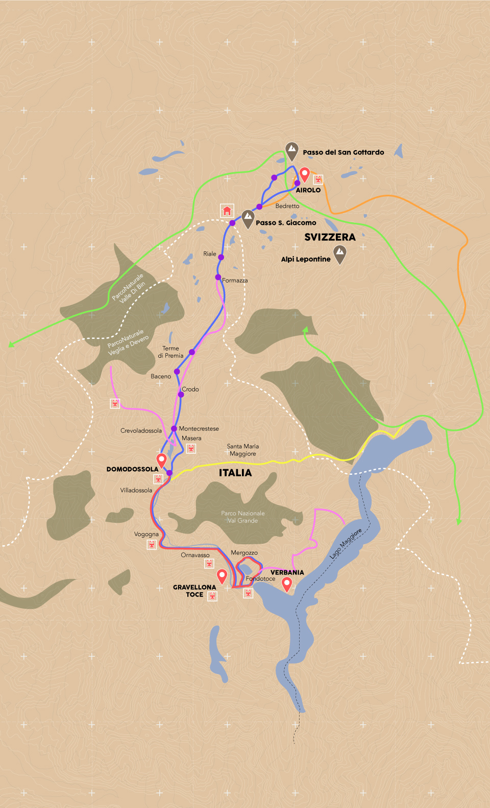
The map
Touch the routes to filter according to your preferences:
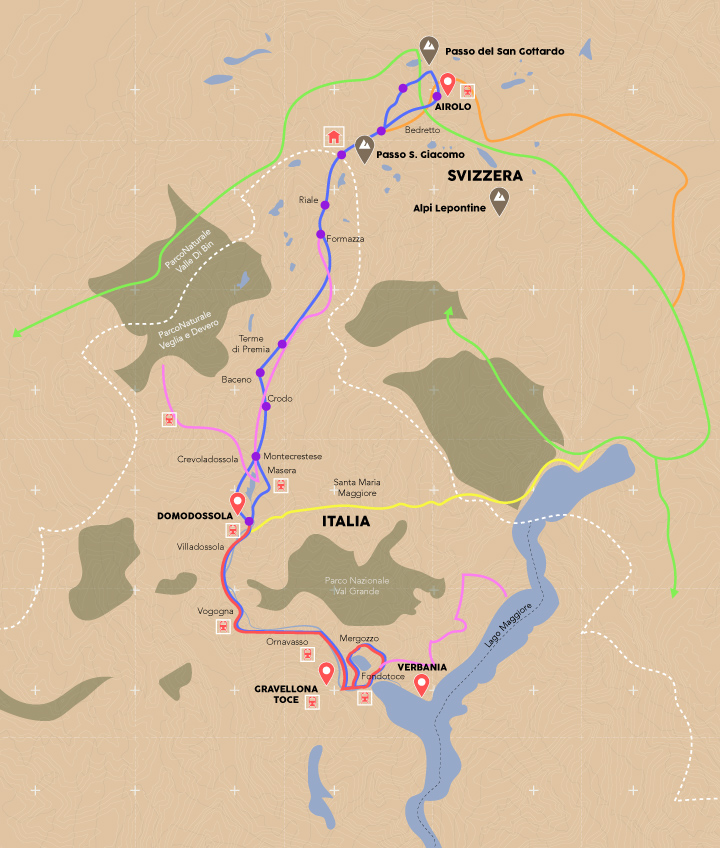
Legend
- Charging stations
- Natural parks
- State border
-
 Refuge/Bicigrill
-
 Railway stations

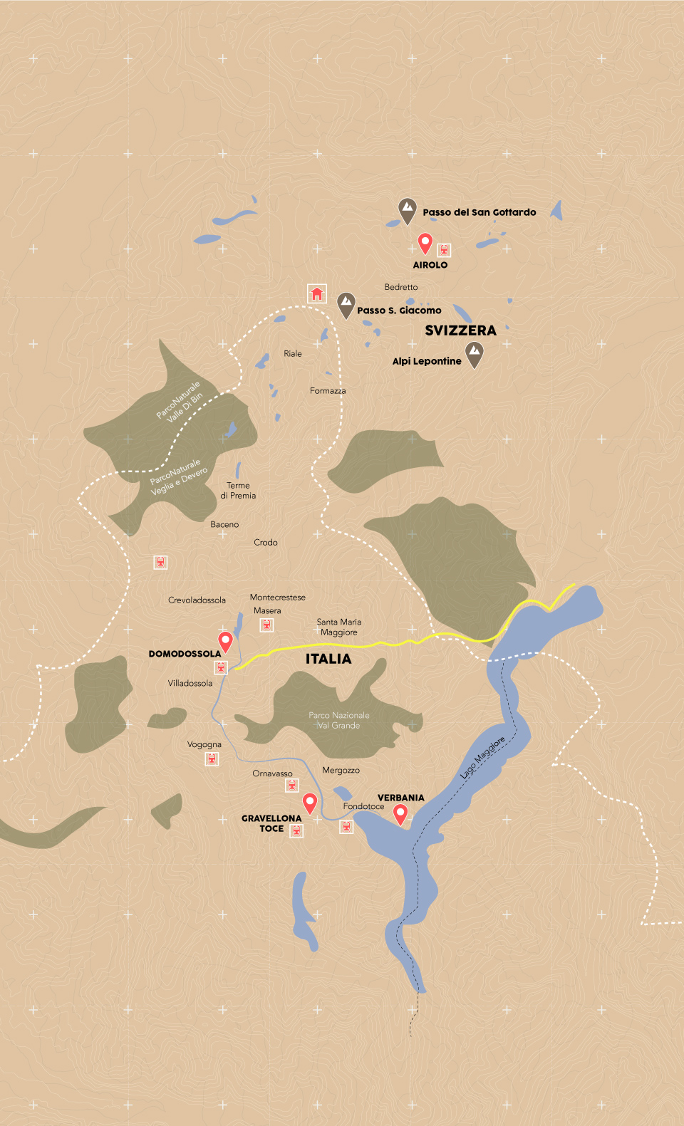


Orient with us
Download the maps of all the itineraries and discover wild and unspoilt roads that wind between Italy and Switzerland.
The routes are suitable for mountain bikes, e-bikes and gravel bikes.
Toce cycle path - Sport Hill of Villadossola
Cycle Lane
17,5 Km - 2.00 h
Difficulty: Very easy

Toce cycle path - By bike among the villages
Mountain bike - Gravel
19,2 Km - 2.00 h
Difficulty: Very easy
Toce cycle route - By bike through the woods
Mountain bike - Gravel
14 Km - 1.30 h
Difficulty: Very easy
Toce cycle path - By bike among the flowers
Mountain bike - Gravel
14 Km - 1.00 h
Difficulty: Very easy
Toce cycle route - By bike among the rivers
Mountain bike - Gravel
18,5 Km - 1.15 h
Difficulty: Very easy
Toce MTB route
Mountain bikes
53 Km - 5.30 h
Difficulty: Medium
Riale - Bedretto
Mountain bike
40 Km - 4.00 h
Difficulty: Medium
Villages of Valle Antigorio
Mountain bikes
18 Km - 2.00 H
Difficulty: Medium
Tour of Cistella
Mountain bikes
36,7 Km - 5.30 h
Difficulty: Challenging